• This is slide 1 description. Go to Edit HTML of your blogger blog. Find these sentences. You can replace these sentences with your own words.
  • This is slide 2 description. Go to Edit HTML of your blogger blog. Find these sentences. You can replace these sentences with your own words.
  • This is slide 3 description. Go to Edit HTML of your blogger blog. Find these sentences. You can replace these sentences with your own words.
  • This is slide 4 description. Go to Edit HTML of your blogger blog. Find these sentences. You can replace these sentences with your own words.
  • This is slide 5 description. Go to Edit HTML of your blogger blog. Find these sentences. You can replace these sentences with your own words.

Selasa, 31 Juli 2018

INDOSURTA GROUP| MANADO SUPPLIER ALAT UKUR SURVEY SE INDONESIA


INDOSURTA GROUP | MANADO


Kini Hadir Dikota Semarang INDOSURTA GROUP CABANG SEMARANG.

Sebagai Suplayer Alat Ukur survey Terlengkap & Terpercaya.Sudah berdiri sejak tahun 2010

sehingga pelanggan pun sudah tidak asinglagi.

Jadi percayakan pengadaan anda ke perusahan kami di manapun anda berada Kini INDOSURTAGROUP Menjadi 9 Cabang Di Seluruh INDONESIA .


Sebagi Supplayer Alat survey Kami mengutamakan Kualitas alat & Kenyamana anda dalam pelayanan kami plus di berikan training alat.


Selain penjualan kami juga menyedikan jasa service kalibrasi alat survey seperti

Total Station Topcon

Total Station Sokkia

Total Station Nikon DLL.


Digital Theodolite Topcon

Digital Theodolite  Sokkia

Digital Theodolite  Nikon DLL.


Automatic Level Topcon

Automatic Level Sokkia

Automatic Level Nikon DLL.


Produk – produk, sbb :

Surveying Instrument & Mapping Equipment

Total Station :

Total Station Topcon OS 101, 102, 103, 105, 107

Total Station Topcon ES 101, 102, 103, 105, 107

Total Station Topcon GTS 102N, 105N, 255N

Total Station Sokkia FX 101, 102, 103, 105

Total Station Sokkia CX 101, 102, 103, 105

Total Station Sokkia SET 02N, 05N

Total Station Nikon DTM 322, 352, 362

Total Station Nikon Nivo 3m, 5m, 3c, 5c

Digital Theodolite :

Digital Theodolite Topcon DT 205, 205L, 209, 209L

Digital Theodolite Sokkia DT 540, 740, 940

Digital Theodolite Nikon NE 100, 101, 102, 103

Digital Theodolite Ruide ET 02, 05

Digital Theodolite South ET 02, 05

Digital Theodolite Minds CDT 02, 05

Automatic Level :

Automatic Level Sokkia B-20, B-30, B-40

Automatic Level Topcon AT-B2, AT-B3, AT-B4

Automatic Level Nikon AC2S, AX2S

GPS Navigasi / Maps :

GPSMAP Garmin 62S

GPSMAP Garmin 78S

GPS Garmin Etrex 10, 20, 30

GPS Garmin Montana 650

GPS Garmin Oregon 650

GPS Garmin 585 Echosunder

GPS Trimble Juno SB, SC, SD, 3D

Fishfinder, Rangefinder

Hypsometer Nikon Forestry Pro

Binoculars Nikon

Compass :

Compass Suunto KB-14

Clinometer Suunto PM-5

Tandem Suunto 360PC

Compass Geologi Brunton 5006, 5008, 5010

Battery Charger :

Battery Charger Topcon BT-32Q, BT-52QA, TBB-2, BDC 70

Battery Charger Sokkia BDC 25, BDC 35, BDC 46B, BDC 58, BDC 70

Battery Charger Nikon BC 65, BC 80

Battery Charger South NB-10A, NB-20, NB-10B, NB-20A

Charger :

Charger Topcon BC-20CR, BC-27CR, TBC-2, BC-G1C, BC-19B,

Charger Sokkia CDC 68, Dual Charger CDC 68

Charger Nikon Q-75E

Aksesoris :

Prisma Polygon Topcon, Sokkia, Nikon, Leica

Prisma Single Topcon, Sokkia, Nikon, Leica

Alumunium Tripod Topcon, Sokkia, Nikon

Pole Stick Prisma Topcon, Sokkia, Nikon, Leica

Alat Survey & Alat Geologi Lainnya :

Meteran Stilon Yamayo 50M

Meteran Tajima 100M

Binocular Nikon

Leica Disto D3ABT

Leica D210

Palu Etswing

Plagging Tape

Diagonal Eyepiece

Reflective Sheet

Handly Talky ICOM V-80


Service Center Survey Equipment:

Service & Kalibrasi Total Station:

Sokkia/Nikon/Sokkia/Leica/South/Horizon/Ruide

Service & Kalibrasi Theodolite:

Sokkia/Nikon/Sokkia/Leica/South/Horizon/Ruide

Service & Kalibrasi Automatic Level:

Topcon/Nikon/Sokkia/Leica/South/Horizon/Ruide. Dll.

Head Office :
INDOSURTA JAKARTA
Perumahan Nusa Loka Sektor XIV,5
Jl. Giliraja  Blok Q1 No.6
BSD City, Serpong – Tangerang Selatan
Tel : 021-53158019-21

Branch Office :
INDOSURTA BALIKPAPAN
Komplek Kumala Residence
Jl. Diponegoro No.C8
Balikpapan – Kalimantan Timur ( 0813 2212 5494 )

Branch Office :
INDOSURTA MAKASSAR
Jl. Poros Maros Makassar
Komplek Griya Batas Kota
Jl. Asoka Blok D.9 No.6
Makassar Maros – Sulawesi Selatan ( 0813 4660 4017 )

Branch Office :
INDOSURTA BATAM
Jl. Sudirman 2
Komplek Simpang Raya Indah
Gabana Blok E.1 No.1
Batam Center – Kepulauan Riau ( 0822 4444 4998 / 0853 5225 5002 )

Branch Office :
INDOSURTA SURABAYA
Jl.Raya Ahmad Yani
Griya Permata Gedangan
Blok C.1 No.22P
Surabaya – Jawa Timur ( 0813 2377 0626 )

Branch Office :
INDOSURTA PALEMBANG
Jl. Raya Perumnas Talang Kelapa Perumahan Sentra Land Residence( Palembang )
Jl. Palem Kuning No. 25 Kel. Talang Kelapa . Kec. Alang – Alang Lebar
Palembang – Sumatera Selatan  ( 0812 4371 1472 )

Branch Office :
INDOSURTA MEDAN
Jl.Sisinga Maha Raja
Taman Riviera Blok MST No.17
Medan – Sumatra Utara ( 0812 2031 6619 )

Branch Office :
INDOSURTA MANADO
Jl. Adipura Perumahan Griya Paniki Indah
Jl. Dahlia Raya III No.5
Manado – Sulawesi Utara ( 0823 1540 8392 /  0853 2157 2599 )

Branch Office :
INDOSURTA CIKARANG
Jl. Puspa X No.3 Mekar Mukti Cikarang Utara
Bekasi – Jawa Barat 17530 ( 0812 8767 9592 / 0896   6880 8504 )


Branch Office :
INDOSURTA SEMARANG
Blok D9 No. 16 Citraland BSB City
Cluster Graha Taman Pelangi BSB
Jl. Burgundi , Mijen
Semarang - Jawa Tengah ( 0813 1835 2259 )


Minggu, 29 Juli 2018

TEMPAT SERVICE KALIBRASI ALAT SURVEY DI MALUKU & TERNATE

                    INDOSURTA CABANG MANADO

Pelayanan Servis Kalibrasi Indosurta Yang Ber Sertifikat Resmi Dan Pelayanan Terbaik Untuk Anda, Hubungi Di :

Nama              : Aan Sutisna

Alamat            : Manado. Perumahan Griya Paniki Indah.
                          Jl. Dahlia Raya III, No. 5

Telp / WA        : 08231540 8392

Email               : aanindosurta@gmail.com


Kami Juga Melayani Penjualan Alat Survey Seperti, Total Station, Digital Theodolite, Waterpass,
GPS Garmin, Aksesoris Dll.


Alat Ukur Indosurta bergerak di bidang penjualan, penyewaan dan service kalibrasi alat-alat survey. Kami hadir lebih luas dan lebih dekat untuk melayani kebutuhan pengukuran anda di bidang konstruksi, telekomunikasi, kehutanan, pertambangan, kelautan, dll.
Kantor Pusat :
Tangerang Selatan
Nusaloka Sektor XIV,5
Jln. Giliraja Blok Q1 No.6
BSD City – Serpong
 CABANG INDOSURTA
-BALIKPAPAN
-MAKASSAR
-BATAM
-SURABAYA
-PALEMBANG
-MEDAN
-MANADO
-CIKARANG
-SEMARANG
“BAGI ANDA YANG BERADA DI DEKAT KANTOR PUSAT MAUPUN CABANG KAMI, KAMI MELAYANI SYSTEM ANTAR JEMPUT, DAN JANGAN KHAWATIR BAGI ANDA YANG BERADA DILUAR KOTA, KAMI SIAP MELAYANI VIA EXPEDISI SESUAI DENGAN YANG ANDA INGINKAN”

Sabtu, 28 Juli 2018

JUAL GPS GEODETICK RTK-V60 DI GORONTALO, MANADO, BITUNG

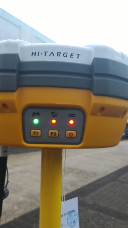
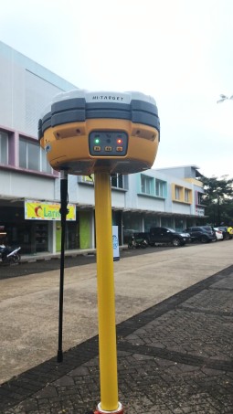
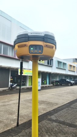
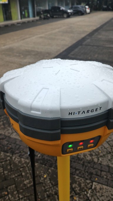
BROSUR SPESIDFIKASI GPS GEODETIK HI TARGET V60 (RTK) BASE + ROVER + RADIO EXSTERNAL
GPS Geodetik Ini dilengkapi dengan Sistem RTK
KELENGKAPAN GPS GEODETIK HI TARGET V60 (RTK) (RTK System Dual Freq With 220 Chanel L1-L1-L2-L2C-GALILEO-GLONAS-SBAS)
KELENGKAPAN GPS GEODETIK HI TARGET V60 (RTK)
1 Unit Base Configuation :
Mother Board Trimble
1 Unit GPS Receiver V60 Chanel (SATIK+RTK)
2 Unit Battery Li-Ion BL5000, 1 Unit UHF Antena Radio For
RTK
1 Unit Quick Charger CL 4400, 1 Unit Tribrach With GPS
Adafter
1 Unit Alumunium Tripod For Heavy Duty
1 Unit Rover Configuation :
1 1nit GPS Receiver V30 220 Chanel
2 Unit Battery Li-Ion BL5000, 1 Unit UHF Antena Radio For
RTK
1 Unit Quick Charger CL 4400, 2 Unit Bracket For Controler
1 Unit Pole 2,5M Alumunium With cm Graduation Red-
White
1 Unit Controler :
1 Unit Controler I Hand 1 With China Language
c/w :
1x Battery
1x Unit Data
Software :
1 Unit CD Software
RADIO EXSTERNAL
FASILITAS CONTROLLER
IHand  FIELD
–          ANDROIID 4.2 OS
–          DURABLE KEYBOARD
–          LIGHTWEIGHT and ANTI DROP DESIGN, IP68 DUST/WATER PROTECTION
–          PREINSTALLED HI SURVEY SOFTWARE
–          ULTRALONG BATTERY LIFE
–           
QMINI MP FIELD CONTROLLER
–          Microsoft Windows Mobile 6.5 OS
–          Preinstalled Free & User-friendly HI-RTK Software
–          Fully Compatible with carison survce, MicroSurvey FieldGenius, Digiterra Explorer, Esri Arcped, etc
–          Lightweight and anti drop design, IP65 Dust/ water protection
POST-PROCESSING SOFTWARE
HI TARGET GEOMATICS OFFICE (HGO) SOFTWARE
–          Provides total GPS/GLONASS/BDS Processing software
–          Standart Rinex Data format and HI-TARGET Raw data format can  be processed flexibly & easily
–          Easy to operation
SPESIFIKASI PERBEDAAN CONTROLLER IHAND20 & Q MINI MP
IHAND20Q MINI MP
QS. Android 4.2QS. Windows Mobile 6.5
SYSTEM CONFIGURATIONProcessor : MT6589, 1.2 Ghz 4 CoreProcessor : 806 Mhz
RAM : 1GBRAM 256 MB
FLASH MEMORY : 4 GBFLASH MEMORY : 8 GB
BluetoothBluetooth
Mini USBMini USB
COMMUNICATION INTERFACEWFI : 802.11b/gWFI : 802.11b/g
MicroSD Car Slot, support up to 32 GBMicroSD Car Slot, support up to 32 GB
Dual Sim Dual Stanby, support 2G & 3GBuilt in 3G Module
POWER SUPPLY3.7V, 6300 mah Lithium battery up to 25 Hours Continous work3.7, 3100 Mah Lithium battery, up to 8 hours continuous work
Physical PropertiesPhysical keyboard.
Size : 213mm x 89mm x 35mm
Weight : 520g (with battery)
Operating temperature : – 30 C to +65 C
Storage temperature : +45 to +75 C
Water/dustproop : IP68
Anti-shock : 1.2 natural fall
10 Keys, include the four ararow keys
Size : 152mm x 82mm x 32mm
Weight : 315g (with Battery)
Operating temperature : – 20 C to +70 C
Storage temperature : +30 to +80 C
Water/dustproop : IP65
Anti-shock : 1.5 natural fall
BROSUR SPESIDFIKASI GPS GEODETIK HI TARGET V60 (RTK) BASE + ROVER + RADIO EXSTERNAL
GPS Geodetik V60 :
–          Menggunakan system RTK sehingga kinerja dilapangan lebih cepat dan efisien
–          Sistem LED nya membuat kinerja lapangan lebih cepat
–          Data rinex Standart dan data mentah HI Target direkam pada waktu bersamaan.
–          Upgrade Data USB Multi Constellation Tracking 220 Tracking Channel
–          Mendukung GPS, Glonass, Galileo, BDS, SBAS, NGS support ke Antena GNSS.
–          CORS System Built in membuat kinearja V60 bekerja lebih semputna ditunjang RTK
–          Ketahanan Battery 5000 MAH
  1.  MEASUREMENT
–          220 Channels
–          Advanced Pasific crest maxowell & customs survey GNSS Technology
–          Hight Precision multiple Correlator for GNSS Pseudo range measurement
–          Unfeltered, unsmothed Pseudo range measurement data for low noise, low multipath error, low
time domain correlation & Hight dynamic response
–          Very low GNSS Carries phase measurement with < 1mm precision in a 1 Hz bandwith
–          Signal to noice ratios reported in dB-Hz
  1.  SATELIT SIGNAL TRACKED SIMULTANEOUSLY
–           GPS……………………. Simultaneously L1C/A, L2C, L2E, LS
–           GLONLASS………….Simultaneous L1C/A, L1P, L2C/A (GLONASS M Only) L2P
–           SBAS…………………. Simultaneous L1 BOC, E5A, E5B, E5AjtBOC
–           BDS…………………… B1, B2
–           QZSS………………..L1 C/A, L1 SAIF, L2C, L5
  1.   POSITIONING PERFORMANCE
  Static and Fast Static GNSS Surveying
–          Horizontal……………2.5mm+0.5ppm RMS
–          VerticaL…………… 5mm+0.5ppm RMS
  1.   Post Processing Kinematic
  (PPK Stop & Go) GNSS Surveying
   Horizontal ………..1cm+1ppm RMS
   Vertical ……………2.5cm+1ppm RMS
   Initialization time………. Typically 10 minutes for base while 5 minutes for rover
   Initialization reliability……. Typically 99.9%
  1.   Real Time Kinematic (RTK) Surveying
   Horizontal …………….8mm+1ppm RMS
   Vertical……………….. 15mm+1ppm RMS
   Initialization time ………..Typically 8seconds
   Initialization reliability…….Typically 99.9%
  1.  Code Differential GNSS Positioning
Horizontal…………….. 25cm+1ppm RMS
VerticaL………………. 50cm+1ppm
SBAS…………………..RMS 0.50m Horizontal, 0.85m Vertical
  1.  HARDWARE
Physical
Dimensions (W x H)……………………18.20cm x 9.80cm (7.17inch x 3.86inch)
WeighT………………………………..1.25kg (2.76lb) without internal battery
Operating temperature………………..-45 Cto +65 C (-49 F to +149 F)
Storage temperature………………. -55 C to +85 C (-67 F to +185 F)
Humidity……………………………………100%, considering
Water/dustproof………………………………………… IP67 dustproof, protected from temporary immersion to depth of 1m (3.28ft).
Shock and vibration……………………………………Designed to survive a 3m(9.84ft) natural fall onto concrete.
  1.  Electrical
–        Power 6V to 28V DC external power input
–        Power consumption S3.5W
–        Automatic switching between internal power and external power Rechargeable, removable 7.4V, 5000mAh Lithium-ion battery in internal battery compartment
  1.  Internal Battery Life
–          Static 13-15 Hourse
–          RTK Rover (UHF/GPRS/3G) 10 – 12 Hours
–          RTK Base 8-10 Hourse
  1.  I/0 Interpace
1x Bluetooth
1x Standart USB 2.0 Port
1x TNC UHF Connector
2x RS232 Serial Port
2x Dc power input (8 Pin & 8.5 Pin)
1x MIcroSD  Card Point
  1.  COMMUNICATION AND DATA STORAGE
3G Communication
Fully integrated, fully sealated internal 3G, compatible with GPRS, GSM Network RTK (via CORS) rabge 20-50cm
  1.  HI – TARGET Internal UHF Radio (Standart)
Frequency………..450-470Mhz with 116 Channels
TRansmiting power…………..         1W, 2W, 5W Adjustable
Transmiting Speed………………..9,6Kbps, 19.2 Kbps
Working Range……………………5 Km Typical, 8-10Km Optimal
  1.  Pasific Crest XDL Micro Internal UHF Radio
Frequency………..403-470Mhz
TRansmiting power…………..         0.5W, 1W, 2W Adjustable
Transmiting Speed………………..Up to 19.2Kbps support most of radio communication protocol
Working Range……………………3-5Km typical, 8-10 Km Optimal
  1.  HI TARGET External UHF Radio (Standart)
Frequency………..450-470Mhz with 116 Channels
TRansmiting power…………..         5W, 10W, 20W 30W Adjustable
Transmiting Speed………………..19.2 Kbps
Working Range……………………8-10Km, 15-20Km Optimal
  1.  PASIFIC Crest ADL Vantage Pro Exsternal UHF Radio
Frequency………..390 – 430 Mhz or 430 – 470 Mhz
TRansmiting power…………..         4W to 35W, 5W Adjustable
Transmiting Speed………………..up 19.2 Kbps support must of radio communication protocol
Working Range……………………8-10Km Tipycal, 15-20 Optimal
  1.  Support Other External Communication Device
For Example, External GSM Modern
  1.  Data Storage
1 GB Internal Storage + 8 GB internalMicro SD Card memory (Support up to 32 GB Extension)
Record GNS and Rinex Format Smuftaneously
  1.  Data Formats
(1 Hz positioning output, up to 50 Hz – dependts on installed option)
CMR : sCMRx, CMR, CMR + Input & output.
RTCM : RTCM 2.1, 2.2, 2.3, 3.0, 3.1, 3.2, INPUT dan OUTPUT
Navigation output binary : GSOF
PERNGERTIAN GPS GEODETIK
Apa itu GPS Geodetic
GPS Geodetic adalah GPS yang mempunyai kemampuan untuk menangkap signal L1, L2, atau GNSS. GPS Geodetic mempunyai kemampuan untuk merekam Raw data, yang secara umum mempunyai Format RINEX. GPS ini mempunyai ketelitian lebih tinggi dari GPS Navigasi. Ketelitiannya bahkan sampai milimeter.
Beda dengan GPS Navigasi, untuk GPS Geodetic minimal untuk mendapatkan ketelitian tinggi harus menggunakan dua alat waktu pengukuran. Jadi satu set GPS Geodetic terdiri dari dua alat, sebagai base station dan sebagai rover.
Aplikasi dari GPS Geodetic antara lain :
1. Untuk penentuan batas wilayah misal : batas antar negara, batas antar wilayah.
2. Penentuan titik kontrol : untuk BPN, Bakosurtanan, Titik Kontrol Tambang.
3. Pemetaaan Topografi
4. Penentuan Volume
5. Stake out : mencari koordinat di lapangan
6. Penentuan titik-titik bor
Hal apa saja yang perlu dipertimbangkan dalam memilih GPS Geodetic :
1. Kemampuan menangkap signal : single frequensi, dual frequency atau GNSS
2. Ketelitian alat
3. Ketahanan batere
4. Kepraktisan alat
5. Kemampuan melakukan pengukuran real timer
6. Kelengkapan alat : Tripod, Pole, controler, receiver, power, radio modem, software
7. Layanan support & garansi.